Lost ? How Do I Find My Way
I live at Lake of the Ozarks, There are more than 1,150 miles of shoreline along the Lake of the Ozarks - more than the coast of California!, 93 miles of lake, The surface of the Lake covers approximately 61,000 square miles.
So how do you not get lost? So as Captain Ron would say
In the past it was with charting maps, Sexton and following the stars and what ever direction the wind blows. But now with GPS, Goggle and other Apps, finding your way on many bodies of water is every easy.
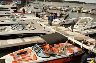
Now here at Lake of the Ozarks, and several other lakes, there are physical signs, such as 911 addresses. On LOZ every dock as a 911 address, it will indicate the numerical property address, city and zip. Most condominiums and on the water /lake side restaurants will have a name or address on the water side. This is also true for sea stores/gas docks and marinas.
Also at LOZ we have Mile Markers along the shore line, However it is import to know, that if you are providing information to emergency personal you need to be specific on the location of the mile marker.
You can not just say I am at the 5 mile marker, due to the fact Lake of the Ozarks have 4 major tributaries, The and Glaze, Osage, Big and Little Niagara, and Gravios. Each have individual mile markers. Example starting at Bagnell Dam it is the 0 mile Marker for the Osage as you go up stream the Mile Markers get bigger. The 0 mile marker for the Gravios is the 6 Mile Marker of the Osage as you go up stream the numbers get larger such as Coconuts is about the 7 mile marker of the Gravios. So one needs to be specific with using mile markers as a location for emergency personal.
If you boat in the Mississippi or Missouri river or even off shore you will find physical signage for properties, businesses, mile markers as well as lock and dam numbers.
This will give you points of references as well as locations to relay to emergency personal if needed.
There are many free apps that will help you in navigation some of them are:
Raftup- this is a free app it is limited to LOZ , Arkansas and I believe some areas in Florida is it also a boating social network. find more information here https://blog.raftup.com/aboutus/
BoatUs - https://www this is limited.boatus.com/products-and-services/app good app if you need location services, emergency assistance, it is nation wide. Free app
Lake Locator - https://apps.apple.com/us/app/lake-locator-lake-of-the-ozarks/id886091160 This is limited to LOZ you can serch for on the water services, Restruants, marinas, Gas docks and more. it is a free app
The app I like to use is Navonics, Boating HD https://www.navionics.com/fin/apps/navionics-boating?gclid=EAIaIQobChMIpMO6gsb96gIVTL7ACh33KAF1EAAYASAAEgJravD_BwE&gclsrc=aw.ds
There is a free app but for a small fee you can up grade to their app that will give water ways in all of North America, or portions, as well as Canada and other charts. You can also do searches for various marine services, restaurants, it will provide charts on water depth, you can make away points, and drop trails to find your way back to the favorite fishing hole. And much more.
These are a few application . it is well worth the time and effort to have a navigation app on your Ipad or cell phone when you are in unfamiliar waters.


Comments
Post a Comment